Surveying Engineering Services: What You Can Expect
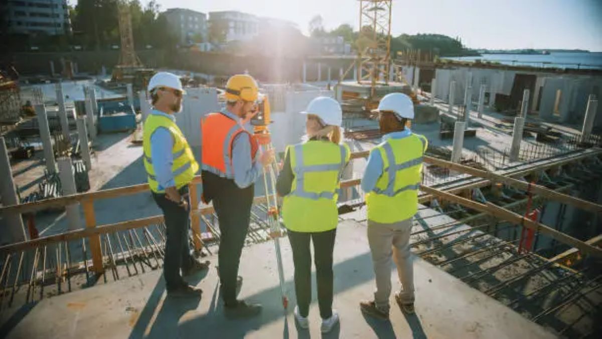
Surveying engineering services are essential for modern infrastructure development. They combine accurate measurements with advanced technology to map and analyse our physical environment. These services involve studying, measuring, and recording land, water bodies, and man-made structures systematically to determine their exact location, size, and shape.
The practice of surveying has been around since ancient civilisations. For example, Egyptian surveyors used basic geometry to recreate property boundaries after the annual flooding of the Nile River. Over time, this important science has evolved from using simple tools like ropes and wooden stakes to sophisticated technologies such as GPS systems and laser scanning.
What Do Surveying Engineers Do?
Modern surveying engineering services include:
- Determining boundaries and mapping properties
- Planning and laying out construction sites
- Supporting infrastructure development projects
- Creating topographic maps and analysing terrain
- Locating underground utilities
- Performing 3D scanning and modelling
Why Are Surveying Engineers Important?
In today’s world, surveying engineers have a crucial role in:
- Urban Development: Ensuring accurate measurements for construction projects
- Legal Documentation: Producing precise property records
- Infrastructure Planning: Assisting with road, rail, and utility installations
- Environmental Protection: Monitoring changes in geography and land use
The knowledge and skills of surveying engineers are vital in many areas of our lives. They contribute to creating smartphone maps that help us navigate daily commutes and establish clear property boundaries that safeguard home ownership rights. Their work provides the necessary data for making informed decisions in construction, urban planning, and infrastructure development.
Core Functions of Surveying Engineers
Surveying engineers perform three essential functions that form the backbone of modern infrastructure and property development:
1. Measurement and Mapping
- Precise documentation of natural terrain features
- Recording of existing man-made structures
- Creation of detailed topographic maps
- Analysis of ground conditions and elevation changes
2. Property Boundary Establishment
- Legal boundary determination through historical records
- Physical marking of property corners
- Preparation of legal descriptions for property transactions
- Resolution of boundary disputes through expert documentation
3. Spatial Information Management
- Creation of comprehensive digital databases
- Integration of multiple data layers for planning
- Real-time updates of geographic information
- Development of 3D terrain models
These core responsibilities require advanced technical expertise and specialised equipment. Surveying engineers use high-precision instruments to collect millimetre-accurate measurements, ensuring reliable data for construction projects, legal documentation, and urban planning initiatives.
The data collected through these functions supports critical decision-making processes in:
- Urban development projects
- Infrastructure planning
- Environmental assessments
- Legal property transactions
- Construction site preparation
Modern surveying practices combine traditional measurement techniques with cutting-edge technology to deliver accurate, reliable spatial information that serves as the foundation for development projects across public and private sectors.
Disciplines Within Surveying Engineering
Surveying engineering encompasses several specialised disciplines, each contributing unique methodologies and expertise to the field:
1. Geodesy
Geodesy is the scientific study of Earth’s shape, orientation, and gravitational field. It establishes precise coordinate systems for mapping and determines accurate positions of points on Earth’s surface. Geodesy is essential for large-scale infrastructure projects.
2. Photogrammetry
Photogrammetry extracts measurements from aerial photographs and satellite imagery. It creates detailed 3D models of terrain and structures, enables rapid data collection across vast areas, and supports urban planning and environmental monitoring.
3. Geographic Information Systems (GIS)
Geographic Information Systems (GIS) integrates spatial data with descriptive information. It analyses complex geographical relationships, creates interactive maps and visualisations, and aids decision-making in land management.
4. Cadastral Surveying
Cadastral surveying determines legal property boundaries, creates official land title documentation, maintains accurate property records, and resolves boundary disputes.
5. Digital Mapping Technologies
Digital mapping technologies combine remote sensing with advanced software to produce high-resolution digital terrain models. They integrate real-time data collection and enable precise 3D visualisation of surveyed areas.
These disciplines work together, using modern technology to provide comprehensive surveying solutions. By integrating these specialised fields, surveying engineers can take on complex projects such as small-scale property surveys or large infrastructure developments.
Modern Technologies Used in Surveying
The surveying industry has experienced a technological revolution with advanced instruments transforming traditional practices. These innovations provide unprecedented accuracy and efficiency in data collection and analysis.
GPS Technology
- Real-Time Kinematic (RTK) GPS systems achieve centimetre-level accuracy
- Multi-constellation receivers capture signals from GPS, GLONASS, and Galileo satellites
- Network RTK solutions provide instant corrections for enhanced precision
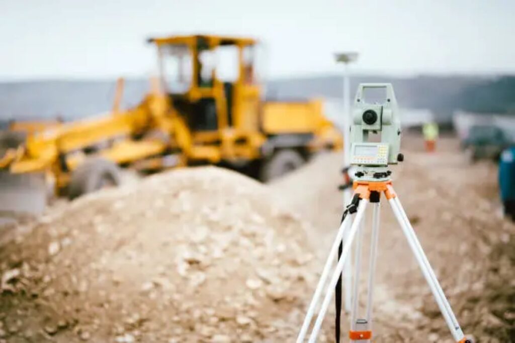
Electronic Theodolites and Total Stations
- Digital readings eliminate manual calculation errors
- Automated tracking capabilities speed up measurement processes
- Built-in data storage systems enable seamless integration with software
- Accuracy levels reaching 0.5 arc-second for angle measurements
Satellite Imagery and Remote Sensing
- High-resolution imagery captures detailed terrain features
- Multispectral sensors detect variations in vegetation and land use
- LiDAR technology generates precise 3D point clouds
- Thermal imaging identifies subsurface anomalies
These technological advancements enable surveyors to:
- Complete projects faster with reduced field time
- Create detailed 3D models of surveyed areas
- Monitor environmental changes with greater accuracy
- Perform surveys in challenging terrain or weather conditions
The integration of these modern tools with traditional surveying principles ensures reliable data collection for infrastructure development, construction projects, and environmental monitoring applications.
Types of Surveying Engineering Services Offered
Professional surveying firms deliver a comprehensive range of specialised services designed to meet diverse project requirements across multiple sectors:
1. Property Boundary Surveys
- Precise determination of property lines and corners
- Creation of detailed boundary documentation
- Resolution of boundary disputes
- Subdivision planning and implementation
2. Construction Site Services
- Pre-construction site analysis
- Topographic mapping for site planning
- Building layout and alignment
- As-built surveys for completed structures
3. Infrastructure Sector Surveys
- Road and highway alignment surveys
- Railway corridor mapping
- Utility network documentation
- Telecommunications infrastructure positioning
4. Subsurface Utility Services
- Non-destructive underground utility detection
- 3D mapping of buried infrastructure
- Depth and location verification
- Clash detection for new installations
These services integrate seamlessly with modern construction and development practices, supporting projects from initial planning through to completion. Each service category requires specific expertise and sophisticated equipment to deliver accurate, reliable results that meet industry standards and regulatory requirements.
The combination of these specialised services enables surveying firms to support complex projects while maintaining high precision standards across all aspects of their work. This comprehensive approach ensures clients receive complete solutions tailored to their specific project needs.

Specialized Consulting Services in Surveying
Surveying engineering extends beyond traditional measurement services into specialised consulting roles that address complex project requirements. Professional consulting services blend surveying expertise with engineering solutions to deliver comprehensive project outcomes.
Site Investigation Project Management
- Detailed geological assessments
- Environmental impact studies
- Risk analysis and mitigation strategies
- Coordination of multi-disciplinary teams
- Development of investigation frameworks
Indigenous Procurement Consulting
- Cultural heritage preservation guidance
- Stakeholder engagement protocols
- Traditional land-use considerations
- Support for tender documentation
- Compliance with Indigenous procurement policies
Integrated Professional Services
- Custom engineering solutions
- Technical feasibility studies
- Project scope development
- Quality assurance protocols
- Resource allocation strategies
These specialised services create value through expert knowledge application and strategic project planning. The integration of traditional surveying methods with modern consulting approaches enables successful project delivery across diverse sectors. Professional consulting teams work closely with clients to understand specific requirements, develop tailored solutions, and implement effective project management frameworks that ensure successful outcomes.
The combination of technical expertise and strategic consulting capabilities allows surveying professionals to tackle complex development challenges while maintaining high standards of accuracy and reliability in their work. Click here to get more about what Is Utility Mapping and why does it matter in construction.
Key Industry Sectors Served by Surveyors
Surveying engineering services play a vital role across diverse industry sectors, with significant contributions to critical infrastructure development and public works projects.
1. Telecommunications Sector
Surveyors support the telecommunications sector in various ways, including:
- Supporting Telstra and NBN network expansions
- Mapping optimal routes for fiber optic installations
- Conducting site surveys for tower placement
- Identifying underground utility locations for cable laying
2. Government Infrastructure
Surveyors collaborate with government bodies on infrastructure projects, such as:
- Partnering with School Infrastructure NSW (SINSW) for educational facility development
- Providing detailed topographic surveys for new school construction
- Assessing existing structures for renovation projects
- Creating precise boundary documentation for property acquisitions
3. Public Works and Council Projects
Surveyors work alongside local councils on public works initiatives, including:
- Collaborating with city councils on urban development initiatives
- Mapping public spaces for community infrastructure
- Conducting surveys for road construction and maintenance
- Supporting drainage system planning and implementation
The telecommunications sector relies heavily on surveying expertise for network infrastructure development. These services ensure proper placement of communication towers, underground cable routes, and network facilities. Government bodies engage surveying services for large-scale infrastructure projects, particularly in the education sector where precise spatial data guides facility planning and construction.
Local councils depend on surveying services for public works projects ranging from road construction to park development. These partnerships help maintain and improve community infrastructure while ensuring compliance with local regulations and standards.
Education and Career Pathways in Surveying Engineering
A career in surveying engineering starts with comprehensive educational programmes that blend theoretical knowledge with practical applications. Professional surveying qualifications require dedicated study across multiple disciplines:
Core Curriculum Components:
- Advanced mathematics and physics principles
- Survey law and legal frameworks
- Field measurement techniques
- Digital mapping technologies
- Photogrammetry and remote sensing
- Geodetic surveying methods
- Soil mechanics and site analysis
Modern surveying education emphasises hands-on experience with state-of-the-art equipment. Students gain proficiency in:
- GPS/GNSS systems
- Electronic total stations
- 3D laser scanners
- Computerised Field-to-Finish systems
- Digital levels and theodolites
The career landscape for qualified surveying engineers spans diverse sectors:
Private Sector Opportunities:
- Property development firms
- Construction companies
- Engineering consultancies
- Mining operations
- Utility service providers
Public Sector Positions:
- Local council planning departments
- State land registries
- National mapping agencies
- Infrastructure development bodies
- Environmental protection agencies
Professional development continues through specialised certifications and ongoing training in emerging technologies. Many surveyors pursue additional qualifications in project management, GIS applications, or specific industry sectors to enhance their expertise and career prospects.
Importance of Surveying Data in Decision Making
Accurate spatial data is essential for making informed decisions in various industries. Here are some key areas where precise surveying data is crucial:
Property Transactions
Property transactions heavily depend on accurate boundary surveys to avoid legal disputes and comply with local regulations. These surveys provide important information about:
- Determining property lines
- Identifying easement locations
- Ensuring zoning compliance
- Meeting building setback requirements
Resource Management
Satellite imagery and environmental assessments are vital tools in resource management. They provide valuable insights for:
- Classifying land use
- Mapping vegetation
- Inventorying natural resources
- Studying the impacts of climate change
Urban Planning
Reliable geographic information systems (GIS) data is crucial for urban planning decisions. This data helps shape sustainable development by influencing:
- Infrastructure placement
- Designing transportation networks
- Locating public facilities
- Allocating green spaces
Smart City Initiatives
The combination of advanced surveying technologies and spatial data analysis forms a strong basis for smart city initiatives. Modern urban areas use this information to:
- Optimise traffic flow patterns
- Plan utility infrastructure
- Assess the impacts of development
- Monitor changes in the environment
These insights, driven by data, empower stakeholders to make well-informed decisions that strike a balance between economic growth and environmental preservation, ultimately creating sustainable communities for future generations.